 販売ネットワーク
 パートナーセンター
 メニュー
メニュー
 日本語
日本語
 GNSS受信機
 トータルステーション
 GIS コントローラー
 深浅測量
深浅測量 精密農業
精密農業 CORS
CORS ソフトウェア
 GNSSインフラ
 モニタリング
 GNSS アンテナ
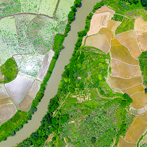
 測量&エンジニアリング
 地理情報システム
 3Dスキャニング&空中写真測量
 深浅測量
深浅測量 PPPサービス
 Monitoring
 パートナーセンター
 予定開催
予定開催 ニュース
ニュース ニュースレター
 ウェビナー
ウェビナー
 会社概要
会社概要 販売ネットワーク
 お問い合わせ
 戦略パートナー
 採用情報
採用情報 パートナー募集
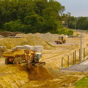


Thank you for your interest in Hi-Target. We will contact you soon.
地理情報システム
地理情報システム(GIS)は、さまざまな種類のデータを収集・管理・分析するためのシステムです。空間的な位置を分析し、最終的にトピックに関する直感的なビジュアルビューを提供します。人間が社会のためにより良い対策と管理を実現できるようにサポートしています。
そのため、確実に精密、多種多様なデータを収集することが大事になります。Hi-Targetは、作業現場に理想的なGIS収集ソリューションを提供しています。例えば、高精度のGNSS受信機、Hi-Target Qbox8, QpadX5、さらにQpadX8やHi-Q、Hi-Q proなどの専門的なGISデータ収集ソフトがあります。精確な座標だけではなく、画像、音声、オブジェクトに関わるほかの重要な特徴データ(ポイントタイプ、ポリラインタイプ、ポリゴンタイプ)などがすべて効率的にスマートデバイスに保存され、そして同時に作業センターまでアップロードされます。
Case Study
 with Survey Software")
Qmini A10(CM) with Survey Software
Qmini A10(CM) GIS Handheld is a new type of rugged centimeter-level precision intelligent terminal product developed by Hi-Target.
さらに詳しく >
High-Precision Positioning Technology to Secure Power System
With high precision positioning technology, assets O&M software, GIS integration and personnel track management platform
さらに詳しく >
RigelMap:High-precision Surveying Integration Solution
RigelMap:High-precision Surveying Integration SolutionBy Rhaegar Lei, Product Manager of Hi-Target International As n...
さらに詳しく >
Precision Agronomics: The Future of Farming Technology
Precision Agronomics: The Future of FarmingTechnologyA GIS solution for Agriculture in Bulgaria by Hi-Target By Lynn ...
さらに詳しく >
High Precision Handheld GIS Data Collector
High Precision Handheld GIS Data Collector For a long time (that) the handheld GIS data collector had served the user...
さらに詳しく >
Site Map  ©2020 Hi-Target and/or its subsidiaries and affiliates. All rights reserved.


©2020 Hi-Target and/or its subsidiaries and affiliates. All rights reserved.